Menu

Blog

Archive for the ‘mapping’ category: Page 33

Feb 13, 2022

Retracing the Astonishing Lifetime Journey of an 17,000-Year-Old Arctic Woolly Mammoth

Posted by in categories: education, mapping

13 Aug 2021

“The proportions of different isotopes of elements present in the bedrock and water create a unique profile, specific to each place on Earth. This profile remains consistent over the millennia and is a kind of “fingerprint” of a region, which can be found in plants, rocks and even animal remains.” National Geographic Poland.

“One of the mammoth’s tusks became a perfect record of all the places the animal visited in its lifetime — with an accuracy almost to the day.”

Continue reading “Retracing the Astonishing Lifetime Journey of an 17,000-Year-Old Arctic Woolly Mammoth” »

Feb 11, 2022

The US Army throws $20 million into AI-equipped, foldable quadcopters

Posted by in categories: drones, mapping, robotics/AI, surveillance

The U.S. Army has awarded a $20 million a year contract to a California-based drone manufacturer, named Skydio, as part of its efforts to move away from foreign-made and commercially available off-the-shelf drones. Skydio revealed in a press release that it would supply its X2D drones for the U.S. Army’s Short Range Reconnaissance (SSR) Program.

With an aim to equip its soldiers with rapidly deployable aerial solutions that can conduct reconnaissance and surveillance activities over short ranges, the Army’s SSR program has been considering small drones for some time now. More than 30 vendors submitted their proposals to the Army, and five finalists were shortlisted for rigorous testing.

Continue reading “The US Army throws $20 million into AI-equipped, foldable quadcopters” »

Feb 9, 2022

Researchers develop a drone-based system to detect marine debris

Posted by in categories: drones, information science, mapping, robotics/AI

The algorithms spot and classify synthetic-material objects based on the distinctive manner in which they reflect polarized light. Polarized light reflected from human-made objects often differs from natural objects, such as vegetation, soil, and rocks.

The researchers tested such a camera, both on the ground and from a US Coast Guard helicopter, which was flying at the altitude at which the polarimetric-camera-equipped drones will fly.

Once fully operational, data collected by the drone-based machine learning system will be used to make maps that show where marine debris is concentrated along the coast to guide rapid response and removal efforts. The researchers will provide NOAA Marine Debris Program staff with training in the use of the new system, along with standard operating procedures manual.

Feb 2, 2022

Global potential for harvesting drinking water from air using solar energy

Posted by in categories: climatology, mapping, solar power, sustainability

Circa 2021


Mapping of the global potential of atmospheric water harvesting using solar energy shows that it could provide safely managed drinking water for a billion people worldwide based on climate suitability.

Jan 28, 2022

Astronomers Discover Mysterious Object in Our “Galactic Backyard” — Unlike Anything Seen Before

Posted by in categories: biotech/medical, energy, mapping, space, sustainability

A team mapping radio waves in the Universe has discovered something unusual that releases a giant burst of energy three times an hour, and it’s unlike anything astronomers have seen before. The team who discovered it think it could be a neutron star or a white dwarf—collapsed cores of stars—wi…


Electric bicycle sales have been on a skyward trajectory since early in the pandemic, and new numbers show they are selling more units than electric cars and plug-in hybrids combined. Those figures recently released by the Light Electric Vehicle Association trade group help bolster the case for personal electric vehicles as alternatives to larger cars […].

Jan 22, 2022

‘Wooorld’ is a Multiplayer Version of ‘Google Earth VR’ for Quest, Releasing Soon

Posted by in categories: mapping, virtual reality

Google Earth VR is a fun and useful way of seeing the world—it’s easy to lose yourself visiting your hometown, or mapping out new adventures thanks to the company’s extensive 3D building scans. Unfortunately Google Earth VR is a PC VR only app, meaning it doesn’t work natively on Quest. That’s not set to change anytime soon, although a third-party Quest app is looking to offer up much of the magic of Earth VR while also making it a multiplayer experience.

Wooorld (that’s three ‘o’s) isn’t being developed by Google, however it appears to be making good use of Google Maps APIs, giving it access to all the 2D and 3D data you’d find on Google Earth VR.

Continue reading “‘Wooorld’ is a Multiplayer Version of ‘Google Earth VR’ for Quest, Releasing Soon” »

Jan 21, 2022

Reinterpreting Our Brain’s Body Maps

Posted by in categories: mapping, neuroscience

Summary: The body relies on multiple maps based on the choice of the motor system.

Source: Tohoku University.

Our brain maps out our body to facilitate accurate motor control; disorders of this body map result in motor deficits. For a century, the body map has been thought to have applied to all types of motor actions. Yet scientists have begun to query how the body map operates when executing different motor actions, such as moving your eyes and hands together.

Jan 9, 2022

Disney Patents Virtual World Simulator That Doesn’t Require Headsets, Goggles, Or Smartphones

Posted by in categories: business, mapping, mobile phones, virtual reality

The immersive tech could eventually allow park visitors to interact with Mickey Mouse and Elsa as images, not cast members in costume.


Disney is joining the metaverse party.

We aren’t talking online gigs or business meetings with avatars. Disney wants to enhance the virtual dimension of its theme parks with its Virtual World Simulator, new technology for which it was granted a patent in the U.S. on December 28.

Continue reading “Disney Patents Virtual World Simulator That Doesn’t Require Headsets, Goggles, Or Smartphones” »

Dec 28, 2021

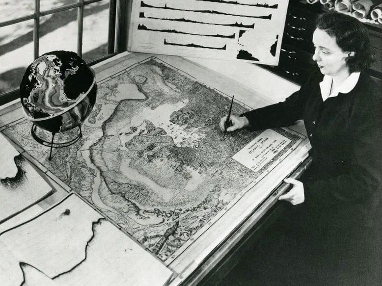
Scientists build new atlas of ocean’s oxygen-starved waters

Posted by in categories: mapping, robotics/AI

Life is teeming nearly everywhere in the oceans, except in certain pockets where oxygen naturally plummets and waters become unlivable for most aerobic organisms. These desolate pools are “oxygen-deficient zones,” or ODZs. And though they make up less than 1 percent of the ocean’s total volume, they are a significant source of nitrous oxide, a potent greenhouse gas. Their boundaries can also limit the extent of fisheries and marine ecosystems.

Now MIT scientists have generated the most detailed, three-dimensional “atlas” of the largest ODZs in the world. The new atlas provides high-resolution maps of the two major, oxygen-starved bodies of in the tropical Pacific. These maps reveal the volume, extent, and varying depths of each ODZ, along with fine-scale features, such as ribbons of oxygenated water that intrude into otherwise depleted zones.

The team used a new method to process over 40 years’ worth of ocean data, comprising nearly 15 million measurements taken by many research cruises and autonomous robots deployed across the tropical Pacific. The researchers compiled then analyzed this vast and fine-grained data to generate maps of oxygen-deficient zones at various depths, similar to the many slices of a three-dimensional scan.

Dec 27, 2021

Why Scientists Have Spent Years Mapping This Creature’s Brain

Posted by in categories: mapping, neuroscience

An enormous new analysis of the wiring of the fruit fly brain is a milestone for the young field of modern connectomics, researchers say.

Page 33 of 52First3031323334353637Last