I sure hope US, Canada, UK, etc. are already for a Quantum Net China.
China is set to become the first nation in the world to launch a quantum communications satellite, which might make its data hacker-proof.
In the last few years, hundreds of contained “nano” satellites known as CubeSats have been launched in low Earth orbit for many purposes, including for collecting targeted scientific data. Federal agencies such as NASA and the National Science Foundation are exploring the potential of these highly affordable satellites in advancing research goals.
A new report from the National Academies of Sciences, Engineering, and Medicine concludes that CubeSats have demonstrated usefulness for scientific data gathering and can also augment – but not replace — the capabilities of large satellite missions and ground-based facilities. The report identifies examples of high-priority science goals that could be pursued through the use of CubeSats in areas such as solar and space physics, planetary science, and Earth science.
In order to continue building the capabilities of CubeSats for research, federal support is crucial, the report says, which identifies several steps NASA and NSF should take to ensure that CubeSats reach their full potential.
Excellent read about future Commerce in Space — could we see an Amazon or a HomeDepot in space?
In space there are no service stations to pull into and get replacement parts for your satellite. Nor is there a towing service if a satellite is in the wrong orbit, a construction contractor to help you build structures, or a “Space Depot” for those who wish to “do-it-themselves” on orbit. In other words, we still operate within a first-generation space industrial enterprise, i.e. all commerce is on Earth, and we only focus on bits (data) coming from monolithic things that go up (i.e., satellites), which eventually die or just come down with no chance of repair or reuse.
Today the commercial space industry focuses exclusively on applications that support launching science, exploration, military, or established earth-bound data communication or delivery services, focusing data to/from space. The lack of technology to support or “markets” to enter has resulted in nebulous, unconsolidated and without-a-critical-mass investment in space-based infrastructure, industrialization, space resources (survey and process maturation) and global utility creation and delivery applications in space. However, all that may finally be changing.
Space applications that are not solely data driven are becoming real. Asteroid mining, fuel depots and commercial space stations are all being actively pursued by companies around the world, as examples of different types of revenue-generating endeavors outside of data-driven end use. These missions and their spacecraft will require greater upkeep, maintenance, repair, and consumable restoration. Consequently, “services” are now being talked about and pursued, executed from one space platform to another. The most talked-about “service” event is providing either consumables (fuel) or failure remediation to satellites on orbit, referred to as “servicing”. However, a handful of companies are seeking to break the shackles that today’s satellites are stuck with at launch, and go well beyond “servicing” into modifying and even constructing new space platforms, on orbit.
Explosive storms spawned by interactions between the magnetic fields of Earth and the sun can endanger satellites, spacecraft and astronauts in space, as well as power grids on Earth. Now, a fleet of NASA spacecraft has for the first time directly witnessed the mysterious way in which these magnetic explosions occur.
This work could help shed light on dangerous solar outbursts and help improve the design of advanced nuclear reactors, researchers said. The discovery was made using NASA’s Magnetospheric Multiscale mission (or MMS for short), which launched four spacecraft into Earth’s magnetosphere, the bubble of plasma controlled by the planet’s magnetic field.
SEE ALSO: Satellite quartet: NASA’s Magnetospheric Multiscale Mission in pictures.
A new underwater GPS.
For all the benefits that the Global Positioning System provides to landlubbers and surface ships, GPS signals can’t penetrate seawater and therefore can’t be used by oceangoing vehicles like submarines or UUVs. That’s why DARPA is creating an acoustic navigation system, dubbed POSYDON (Positioning System for Deep Ocean Navigation), and has awarded the Draper group with its development contract.
The space-based GPS system relies on a constellation of satellites that remain in a fixed position relative to the surface of the Earth. The GPS receiver in your phone or car’s navigation system triangulates the signals it receives from those satellites to determine your position. The POSYDON system will perform the same basic function, just with sound instead. The plan is to set up a small number of long-range acoustic sources that a submarine or UUV could use to similarly triangulate its position without having to surface.
The system should be ready for sea trials by 2018. It will initially be utilized exclusively for military and government operations but, like conventional GPS before it, will eventually be opened up to civilians as well.
India frees itself from the US & Russian GPS system.
Back home, the mission control room of Indian Space Research Organisation(ISRO) resonated with thunderous applause. The scientists who were till then glued to their monitors burst into cheers. India’s mini GPS, a regional positioning system, was ready to be rolled out.
Prime minister Narendra Modi who was watching the launch live from his office in Delhi congratulated the scientists. “With this successful launch, we will determine our own paths powered by our technology. This is an example of made in India and made for Indians,” he said. The navigational structure was given a new name — NavIC (Navigation Indian Constellation) — by the prime minister. “125 crore Indians have got a new Navic,” he tweeted.
Desi GPS The seven-satellite constellation, IRNSS (Indian Regional Navigation Satellite System), is designed to provide a regional positioning system for India with the least number of satellites. It is expected to provide accurate position information service to users in India and 1,500 km around the Indian mainland.
Hmmm; I guess the government needs to change its mode of operations. I believe that everyone has been saying this for a while now.
Technology companies are moving too fast for governments to keep up, according to a former chief of the US Defense Advanced Research Projects Agency (DARPA).
Kaigham (Ken) Gabriel was acting director of DARPA and the man behind drone technology and global positioning satellites, as well as the military’s top secret, high-tech operation responsible for inventing the forerunner to the internet, Arpanet.
He believes governments are fighting a losing battle with technologies such as encryption. But, when it comes to the possibility of advanced tech falling into the wrong hands, he doesn’t believe western governments should give up altogether.
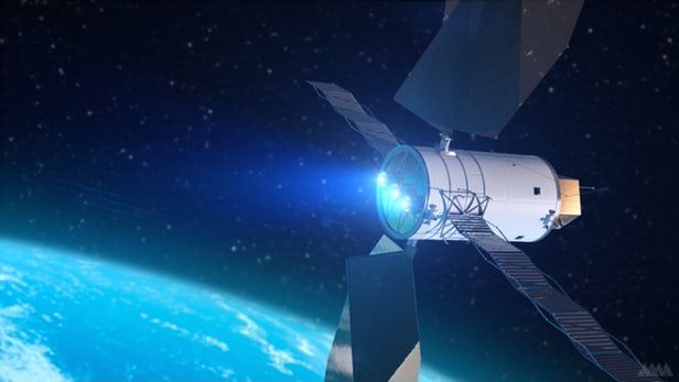
Satellites operators have been longing for it for decades, and DARPA (once again?) is turning their dream into reality: on March 25, one of America’s most futuristic agency announced it would launch a public-private partnership to provide in-orbit servicing to geosynchronous satellites, both commercial and military.
The program dubbed Robotic Servicing of Geosynchronous Satellites (RSGS) will be a major breakthrough for the satellite industry world. Since Sputnik’s launch, the biggest weakness of satellites was that, once on orbit, nothing could be done if something went wrong or once the fuel tank ran dry. A rather embarrassing issue when considering how pricey such platforms are. The only maintenance and repair operations performed to date were manned (Hubble telescope, ISS). The agency announced that it would allocate RSGS $500mn over the next few years, supplemented by commercial partner investment.
DARPA’s RSGS is composed of two elements: the arm that will dock and manipulate the satellite, and the space ship carrying it. Regarding the first element, the agency will provide its Front-end Robotics Enabling Near-term Demonstration (FREND) technology. The prototype of the FREND arm was built for the agency by the California-based company Alliance Space Systems. The robotic arm will enable it to dock with satellites and carry out maintenance.